דוקטורנטים מספרים - Moshe Mandelmilch
Mapping Mediterranean forests in Israel using high-tech drones
Moshe Mandelmilch
Supervisor: Prof. Eyal Ben-Dor
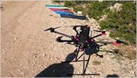
My name is Moshe Mandelmilch, and I am a PhD student at the Remote Sensing Lab in the Department of Geography and Human Environment. My study focuses on the development of novel approaches for mapping the nutritional status of Mediterranean plant communities using remote sensing technologies. Nutritional status is one of the most important parameters for understanding and monitoring the process of growth and development, as well as the health of different plant species. Therefore, it is one of the most commonly explored and discussed research topics in plant ecology. However, forest ecologists have limited resources for these types of studies. Therefore, the use of remote sensing technologies provides deeper insights about this topic in new innovative and efficient ways. These technologies include multispectral satellites, airborne hyperspectral sensors, and multispectral cameras which are mounted on drones. During the study, I am monitoring two different forest plots in Israel: Offer forest and Mizpah Massua forest. In each plot, I have 40 individual plants from four different species (ten from each species). Every few mounts, I approach the plots in order to collect images using a special multispectral camera (Red Edge M) which is mounted on a drone (DJI Matrice pro 600). The final goal of my study is to build models of the nutritional status in plant species in the plots based on their spectral signature. I am especially interested in measuring the nitrogen and phosphorus content of the species in my study. Moreover, I hope that these models will enable better management and be beneficial to Israeli forest authorities such as KKL and the Nature and Parks Authority. It is possible that farmers will also be interested in this study, because it can help to increase the productivity of their crops.


